Environmental Hotspots
(for testing only)

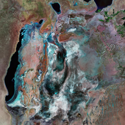


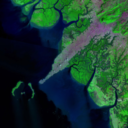
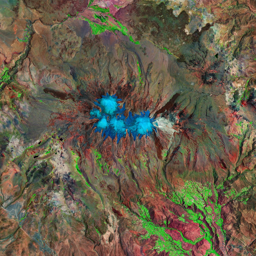
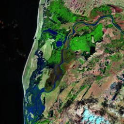


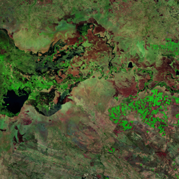
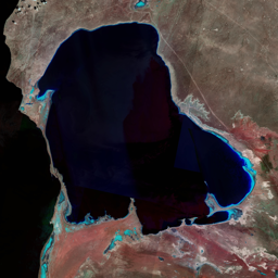
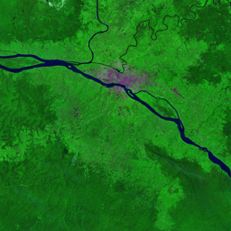
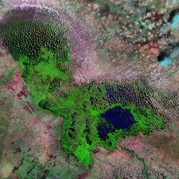

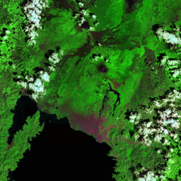

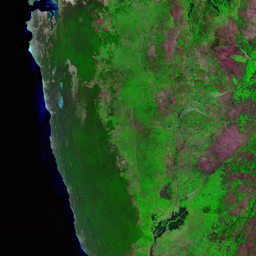


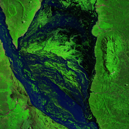


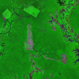

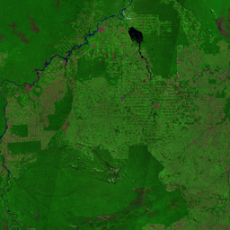
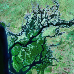

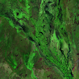

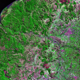
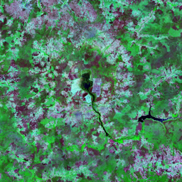
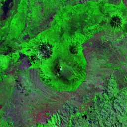
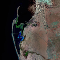

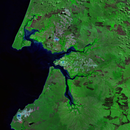
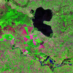
The Sudd is a vast wetland in southern Sudan where the Nile River wanders for nearly 644 km, losing much of its flow to evaporation. During the dryseason the wetlands contract to approximately 8 300 km2 of permanent swamp. During the wet season from April to October, the Sudd overflows intothe surrounding area to cover 80 000 km2. This annual pattern of flooding is an integral part of the ecosystem and is crucial to the local flora and faunaand to the local Nilotic people's way of life.More than 50 per cent of the Sudd inflow is lost to evaporation as it crosses the Bahr el Jebel wetland, reducing the availability of water in thedownstream areas. To ensure a continual water supply to areas in Egypt and Sudan downstream of the Sudd, in the early part of the 20th century,hydrologists proposed the construction of a canal 360 km long, 50 m wide and 4 m deep, which would allow 20 million m3 of water per day to bypassthe swamps. The Jonglei Canal project is designed to reroute a portion of the Nile's flow around the wetland, thus reducing loss through evaporationand increasing the water available downstream for irrigation. The project has been at a standstill since November 1983 when military conflict in thearea stopped construction. The project is now being reconsidered, especially since hostilities ended in 2005. However, should the project resume,scientists are concerned about the possible effects on the ecosystem, climate, groundwater recharge, water quality, fisheries and local people.A 1954 study, The Equatorial Nile Project and its Effects on the Anglo Egyptian Sudan, identified many concerns with the Jonglei Canal that are still asource of controversy today. It concluded that a canal diverting 55 million m3 of the White Nile's water per day would mean the loss of 36 per cent ofpasture and 20 000 metric tonnes of fish. It would also significantly reduce agricultural production. The pastoralists who depend on the area's seasonalflooding will lose the grasses for their cattle and access to drinking water; in addition, the canals will impede their seasonal migration. Several studiessupport these concerns and a little-studied second phase of the project will almost certainly further affect the area.
Use shift + scroll to zoom the map
Use shift + scroll to zoom the map